Introduction
Sentinel-1 is currently the only mission to provide long time series of Synthetic Aperture Radar (SAR) data over land. In order to generate “Analysis Ready Data” for various related applications, CNES, in collaboration with CESBIO, have created and developed since several years an operational processor to generate calibrated and ortho-rectified Sentinel-1 data on the Sentinel-2 grid: S1Tiling.
With this Python software, users can easily use jointly Sentinel-1 and Sentinel-2 time series.
|
⤖ |
|
S1Tiling was developed as an open source project by CNES based on the existing CNES open source project Orfeo Tool Box.
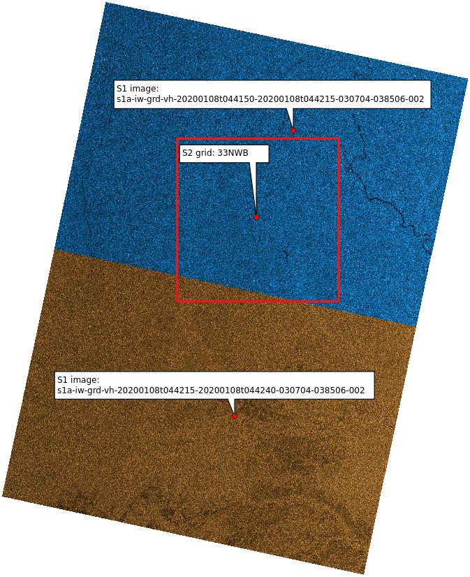
The resulting images are gridded to Sentinel-2 MGRS geographic reference grid (S2 tiling system - zipped kml file). Thanks to EODAG, different Sentinel-1 data providers can be used like Geodes or Copernicus Data Space. It can be used on any type of platform, from a large computing cluster to a laptop (the fan will make some noise during processing). It is considerably faster than the ortho-rectification tool in ESA SNAP software with similar results and can be easily used in script form.
S1Tiling is currently used as Sentinel-1 data pre-processing for many applications, such deforestation detection in the Amazon, monitoring of rice crops in Southeast Asia or monitoring of water stocks in India. In addition, this software will be implemented in GEODES, the French portal for Earth Observation data, in order to provide SAR Ready Analysis Data to users.